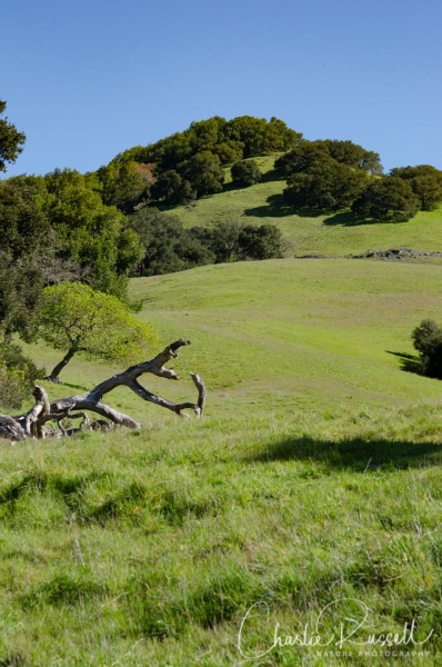
The Mount Burdell Open Space Preserve is a wonderful oasis of green in Marin County that contains a number of hiking trails. There’s an interesting mixture of habitats, with open grasslands, oak forests, a large seasonal pond and some areas with serpentine soils. This gives you an easy-to-access area with a wide variety of flowers.
We visited this area in late February because it is a great place to get an early start on the wildflower season.
The Hike
There is a network of interconnecting trails, so if you aren’t familiar with the area you should download a map. There are two good ones that I found. The map at the Marin County Parks website was the clearest, clearly marking which trails were fire roads and which were trails. This area is open to hikers, mountain bikers and equestrians, so it is helpful to know which trails are open to each use. Another helpful map is the one from the Bay Area Ridge Trail website, which includes topo lines. I’m happy to note that there are excellent trail markers at each of the trail junctions we came to, so navigation was very easy.
There are four access points to the preserve, which aren’t clearly marked on the maps.
- West, from San Andreas drive.
- South, from San Carlos Way.
- East, from Fieldstone Drive.
- North, accessing the Preserve by hiking up through Olompali State Historical Park.
Click the track to see an elevation graph. Move your mouse along the elevation graph to show the location on the map. The Refresh icon will re-center the map. The Expand icon will expand to full screen
Burdell
Profile
We started at the West trailhead. There was adequate parking along the street, although I would imagine it could get crowded on some weekends.
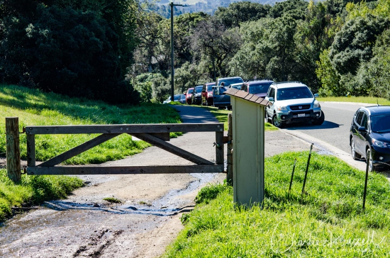
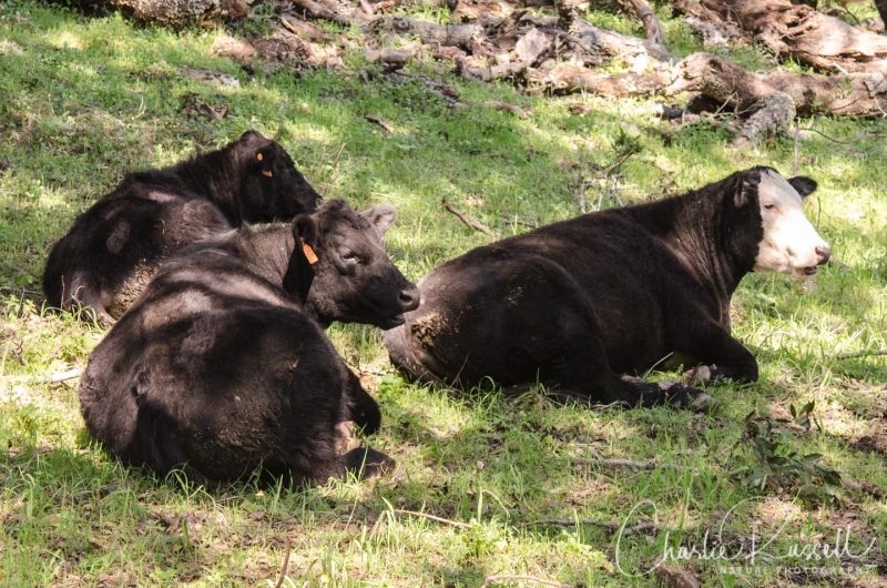
I should mention that many portions of the Preserve are used for cattle grazing. This is important, as it helps control the non-native grasses so that the native plants have a chance to thrive. It also means that you have to be careful to close any gates that you pass through, to keep the cattle in the proper areas. We did encounter cattle at several points, and they pretty much ignored us. The only hazard from cattle that we encountered was actually from a very friendly dog who had a wonderful time rolling about in the fresh cow dung, and then bounded up to greet my wife…
Our loop started uphill along the San Andreas fire road, an easy but somewhat steep climb. Note that along this section on the left there is a small entrance to an area were there are some rare and endangered plants, along the stream. I recommend caution going in there because there is a lot of poison oak, and the flowering plants are hard to find.
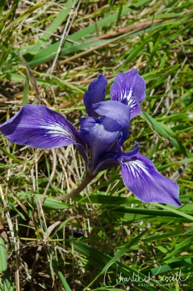
Further up the hill is a side path, the Little Tank fire road, which leads to the Dwarf Oak trail. I didn’t include this in my hike track shown below, but it can be an interesting trip. This takes you up the hill into the serpentine soil hillside, and you can find a different collection of flowers there. This is where I found an early-season Douglas Iris.
At the top of the hill we turned onto the Middle Burdell fire road. Lots of Sun Cups along the way. These are very low in the grass.
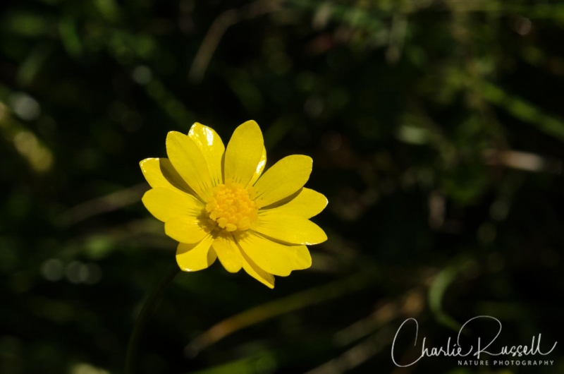
We also saw a large number of California Buttercups all throughout this hike.
This path takes you along Hidden Lake, a seasonal pond. The pond is home to several species of amphibians. Here’s a Pacific Chorus Frog that we found at the edge of the pond.

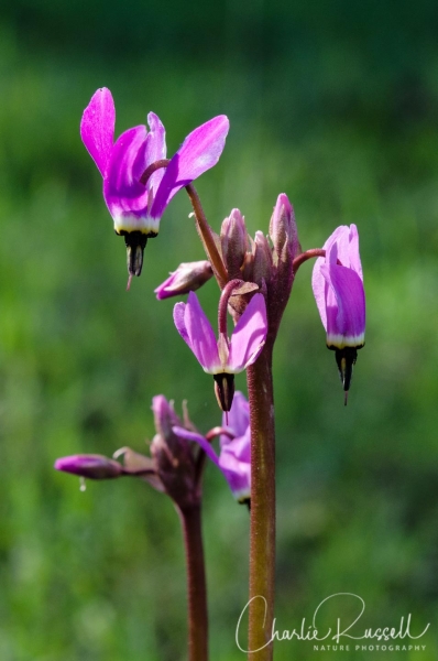
We turned onto the San Carlos fire road to head downhill through the oaks. There were quite a few shooting stars (Mosquito Bill) scattered about in shady spots.
We turned west onto the Michako trail. This area had the widest variety of early flowers, a mixture of native and non-native species.
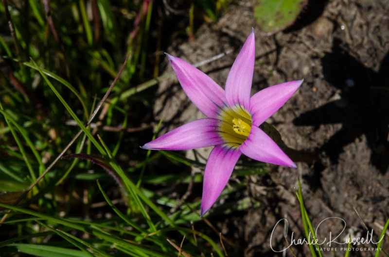
Rosy Sandcrocus is low to the ground but very striking. A non-native plant in the Iris family.
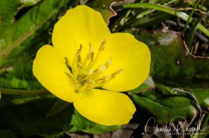
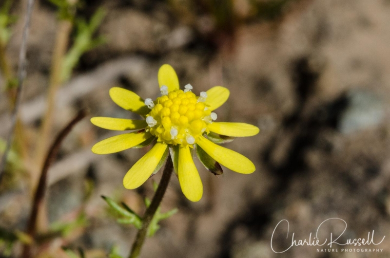
I was also surprised to see Yellow Carpet here. I associate this with vernal pools, so finding them on an exposed hillside was unexpected. There were quite a few wet areas where water was running down the hill.
Timing is Everything
We visited the area on an absolutely gorgeous, clear late February weekday. Some of the earliest blooming flowers were already starting to fade, but there was a lot to see. You won’t find big masses of flowers, but there is something blooming along every path. You could start earlier in February, and I’m sure that there will be interesting flowers all through the spring. Note that some of the trails can get quite muddy earlier in the season. We did tromp across some wet spots, but nothing that caused us any trouble.
Directions
We used the west entrance, which doesn’t have a parking lot but has a fair amount of on-street parking. From Highway 101 in Novato, take the exit for San Marin Drive west. After 2.3 miles turn right onto San Andreas drive. About a half mile up that road you will see the access gate on your right.
The Flowers


In addition to the flowers that I have discussed above, we found:
- Milk maids (quite a few of these)
- Miner’s lettuce
- Purple sanicle
- Blue dicks
- California poppy
- Scarlet pimpernel (non-native)
- American black nightshade
- Fremont’s death camas (quite a few along the Michako trail)
- Western blue eyed grass
- Western houndstongue (on the Dwarf Oak trail)
- Chickweed (non-native)
- Hog fennel (several species)

0 Responses
Mt Burdell is just a mile or so from our home. Great to know the names of the flowers you saw. Beautiful pics!
Jan, you are very lucky to live so close to a wonderful place like Mount Burdell. It would be helpful, if later in the year you get a big bloom of different flowers, if you could drop a comment here? I don’t get a chance to monitor different sites, and it is really helpful to know when to drop by and visit again
I found your site last night and went on this hike today. I had a wonderful time and saw lots of flowers :). So, thank you so much for sharing!
Glad I could help, Lauren. If you are in that area, you’ll like the next hike I’m going to write about after I get the pictures processed. Also in Marin County.
I’m curious, how did you find this article?
I too, live very close by the hike you described. I highly recommend the experience and dogs on a lease, are encouraged. However, the serpentine rock outcropping you described is that off the Michako trail?
That would be the Dwarf Oak trail, essentially. There are exposed serpentine outcroppings in multiple areas (some on the Michako trail, I believe), but the major serpentine area, as I recall, was that facing hillside on the west side of the San Andreas Fire Road. Dwarf Oak Trail takes you through that area. Timing for flowers there will be different than other areas of the preserve.