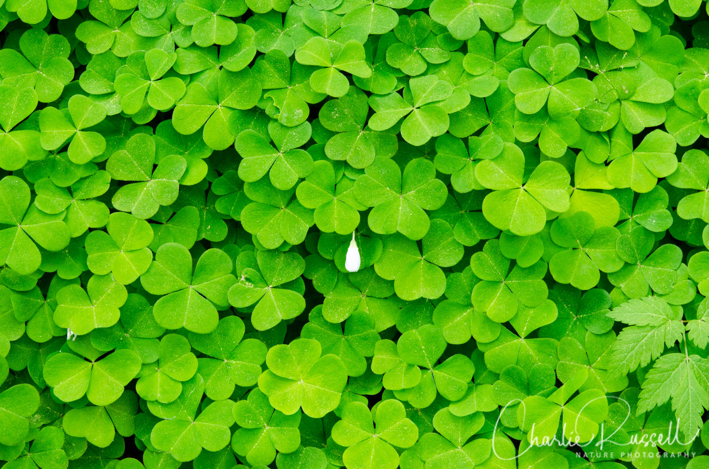
Marys Peak Botanical Special Interest Area has a number of hiking trails that offer a wide variety of wildflowers. Located about 20 miles east of Corvallis, this is probably my favorite wildflower spot from our botanizing tour of Oregon. We were continually amazed by the lush carpets of Redwood sorrel, Starry false lily of the valley, and Vanilla leaf, along with many other flowers.This is the highest point of Oregon’s coast range.
In this post you get two hikes for the price of one, because we hiked both the Meadow Edge and East-Tie-North Loop trails.
Marys Peak Botanical Special Interest Area Wildflowers
Here’s a sample of a few of my favorites from this hike (click on the image to see a larger view).
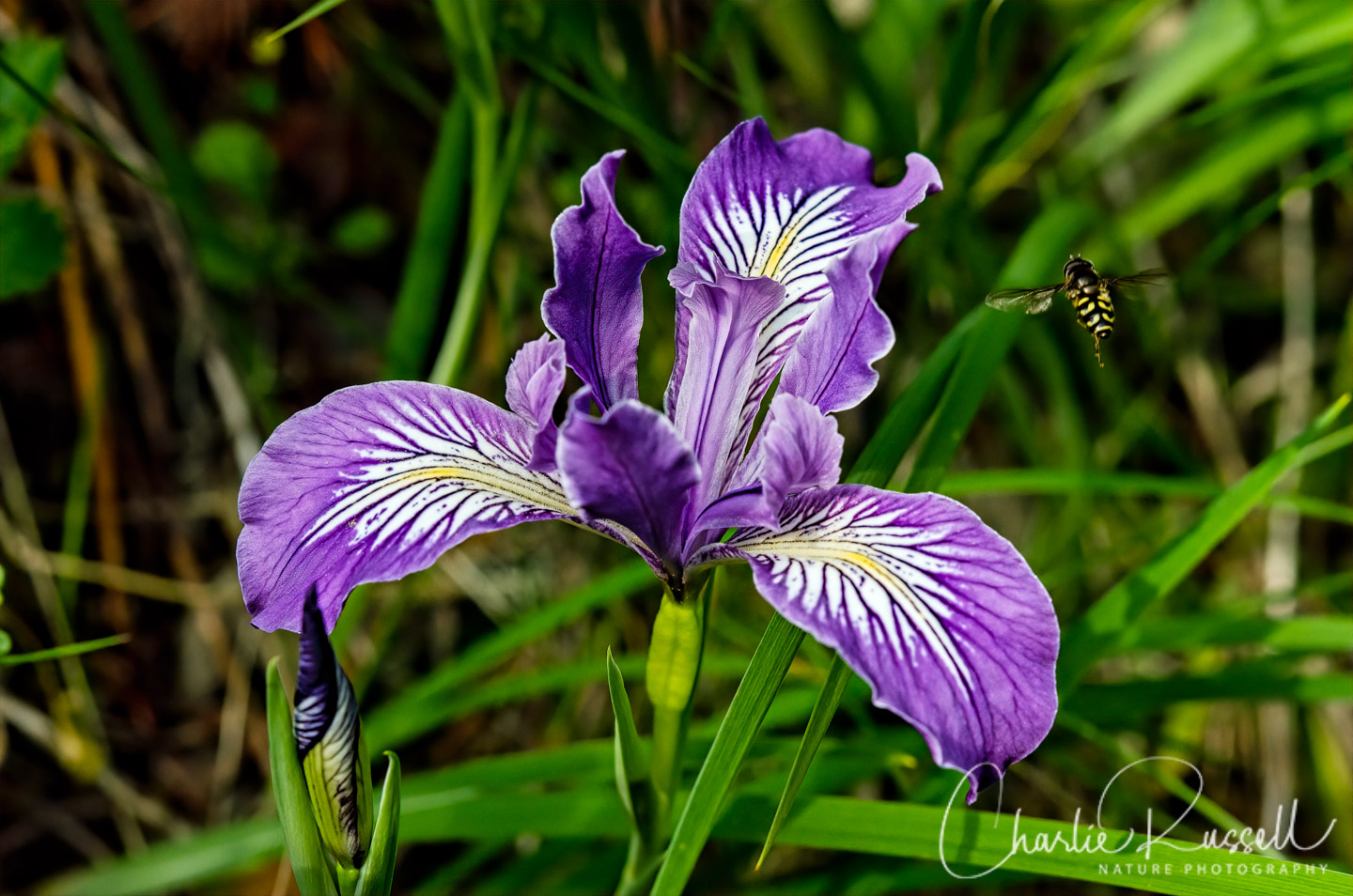
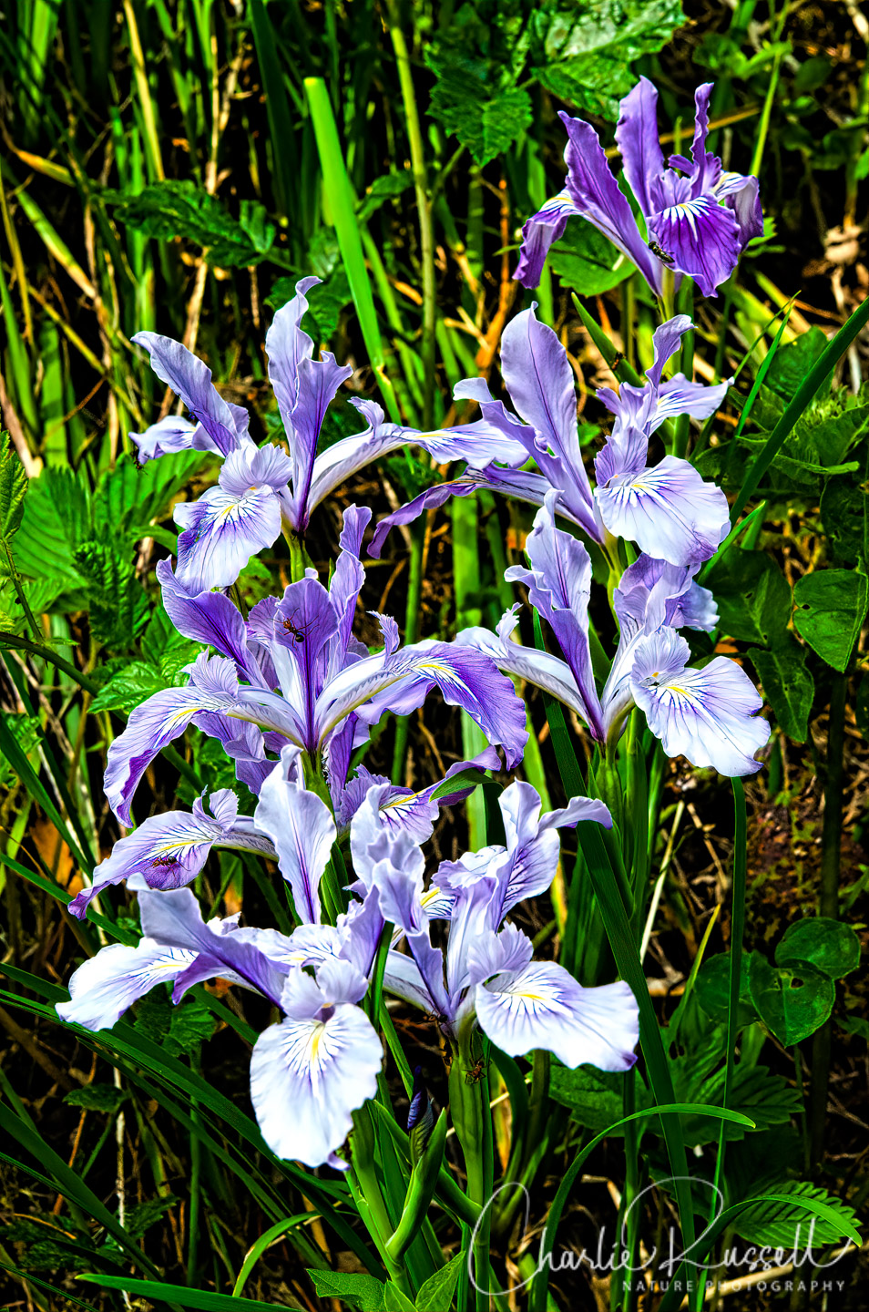
The Oregon iris were at their peak on this visit. With a hover fly (Syrphid) coming in for a landing.
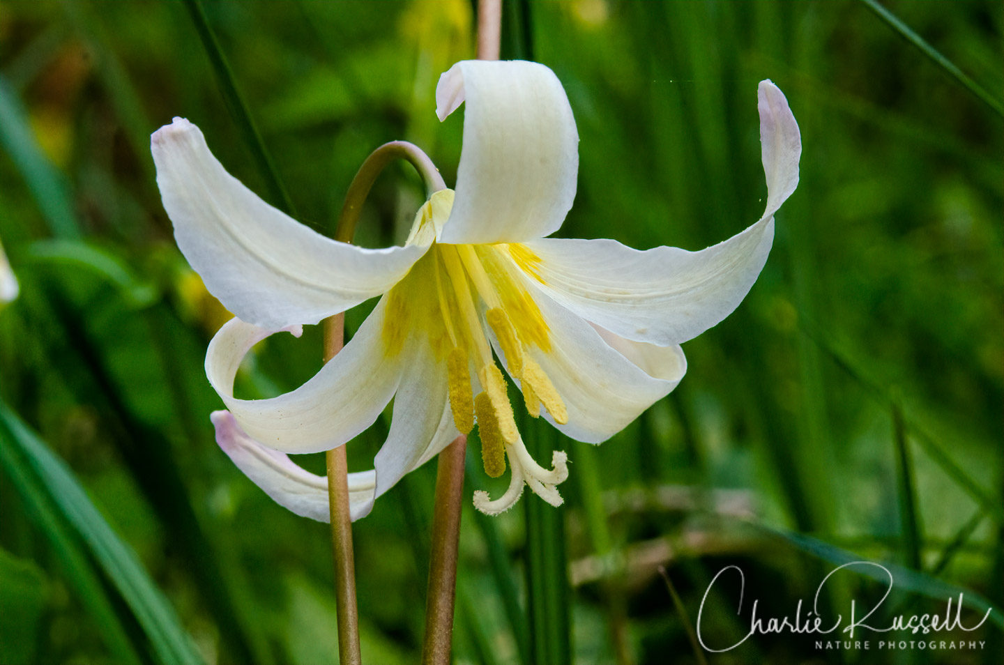
On our hike at Tire Mountain just the day before we reached Marys Peak, we saw the Oregon fawn lily for the first time. But there were only a few at Tire Mountain, and they were past their prime. At Marys Peak there were large numbers of them still blooming at the upper meadow along the edge of the forest, which was exciting!
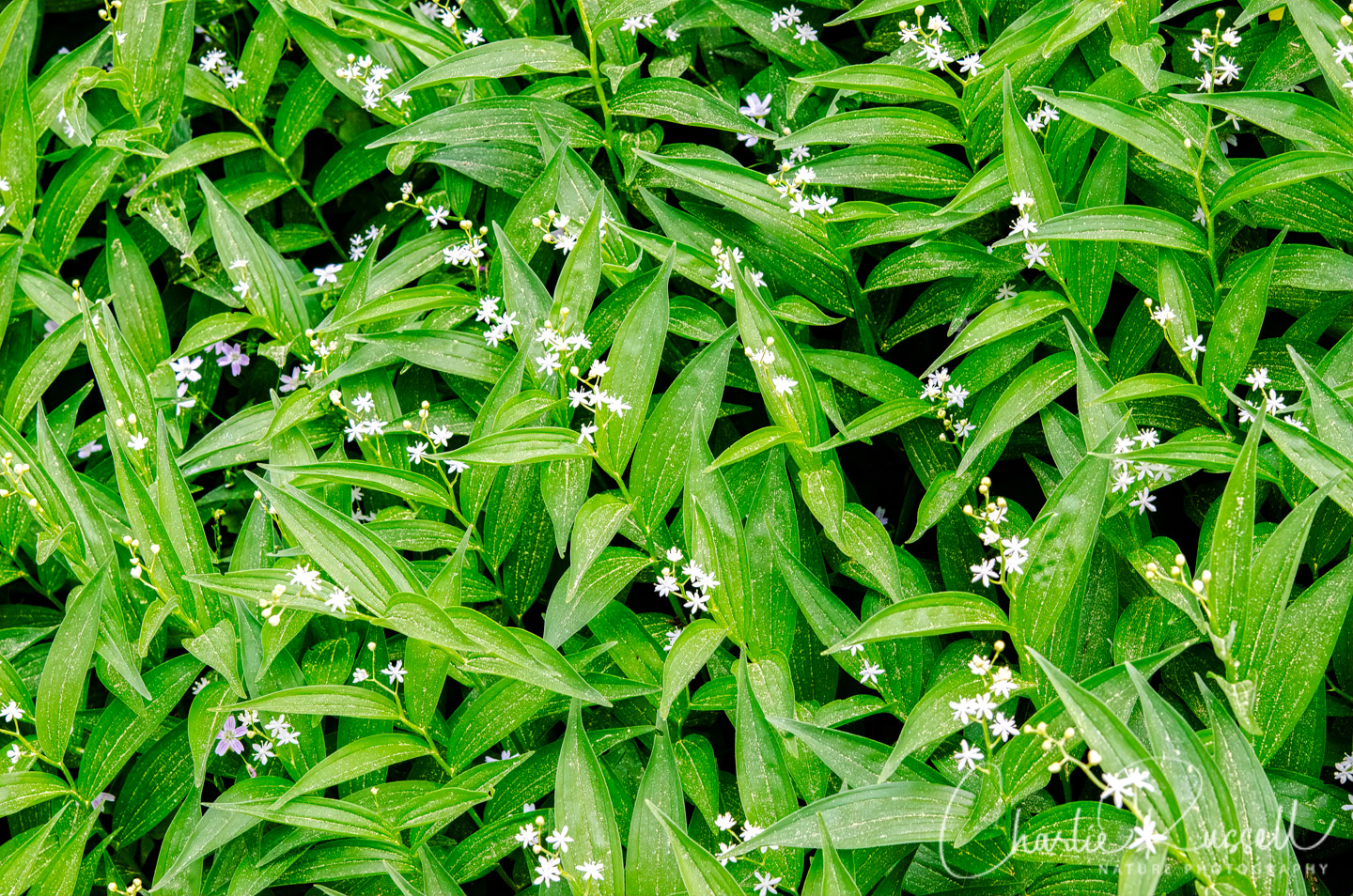
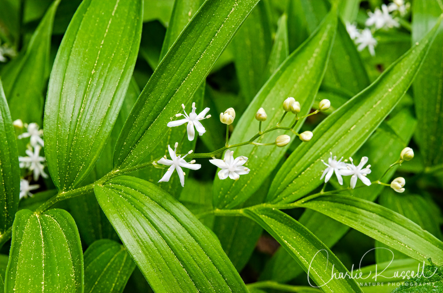
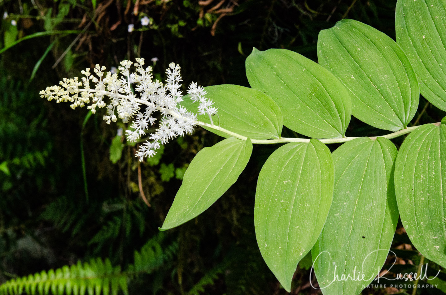
There were two kinds of False lily of the valley (which used to be called False Solomon’s seal), “Starry” and “Feathery”. Here’s a shot of each, so you can see the difference in the inflorescence. The Starry false lily of the valley was just starting to bloom, and some sections of the forest were blanketed with them.
For the best viewing experience, click on the lightbox image below, and you can scroll through larger versions of the photos of many of the plants (and other things) that we found on this hike. All photos are available for purchase in a variety of formats.


, order Polydesmida (flat-backed millipedes), Family Xystodesmidae. Possibly
Harpaphe haydeniana, Almond-scented millipede")


The Hike
There are several trails at Marys Peak, all of which are accessible from the day use area at the end of the road up the mountain. On this visit we chose two combination loops – the Summit/Meadowedge trails and the North Ridge/Tie/East Ridge trails. Both of these start from the south end of the day use parking lot.
Summit/Meadowedge Trail
The Summit Loop trail heads up the hill from the parking lot and then joins with the Meadowedge trail. This trek is about 3.4 miles long, and it takes you through a variety of bioclimes. You have two open meadows, a dry forest (at the top), a darker/wetter forest section, and a riparian glade (although there wasn’t water in the stream at this time).
Starting at the parking lot we followed the gravel road up the hill. There are many flowers along the way as you walk along the “lower meadow”, including many clumps of Western dog violet. Note that there is a narrow trail through that same meadow to your left (which is how we returned), which has a slightly different collection of flowers.
A bit over a quarter mile into the hike (up the hill on the road) there is a trail junction. You can continue straight on the road towards the summit, left on the Summit Loop Trail (which joins the East Ridge trail and heads back to the parking lot), or you can go right (west) to (in a few hundred yards) meet up with the Meadowedge trail, which loops back to this point. On this hike we didn’t go up to the summit, which is described as a “rock garden” that supports a number of flowers you won’t see on other trails here. If you have time, I recommend visiting that area as well.
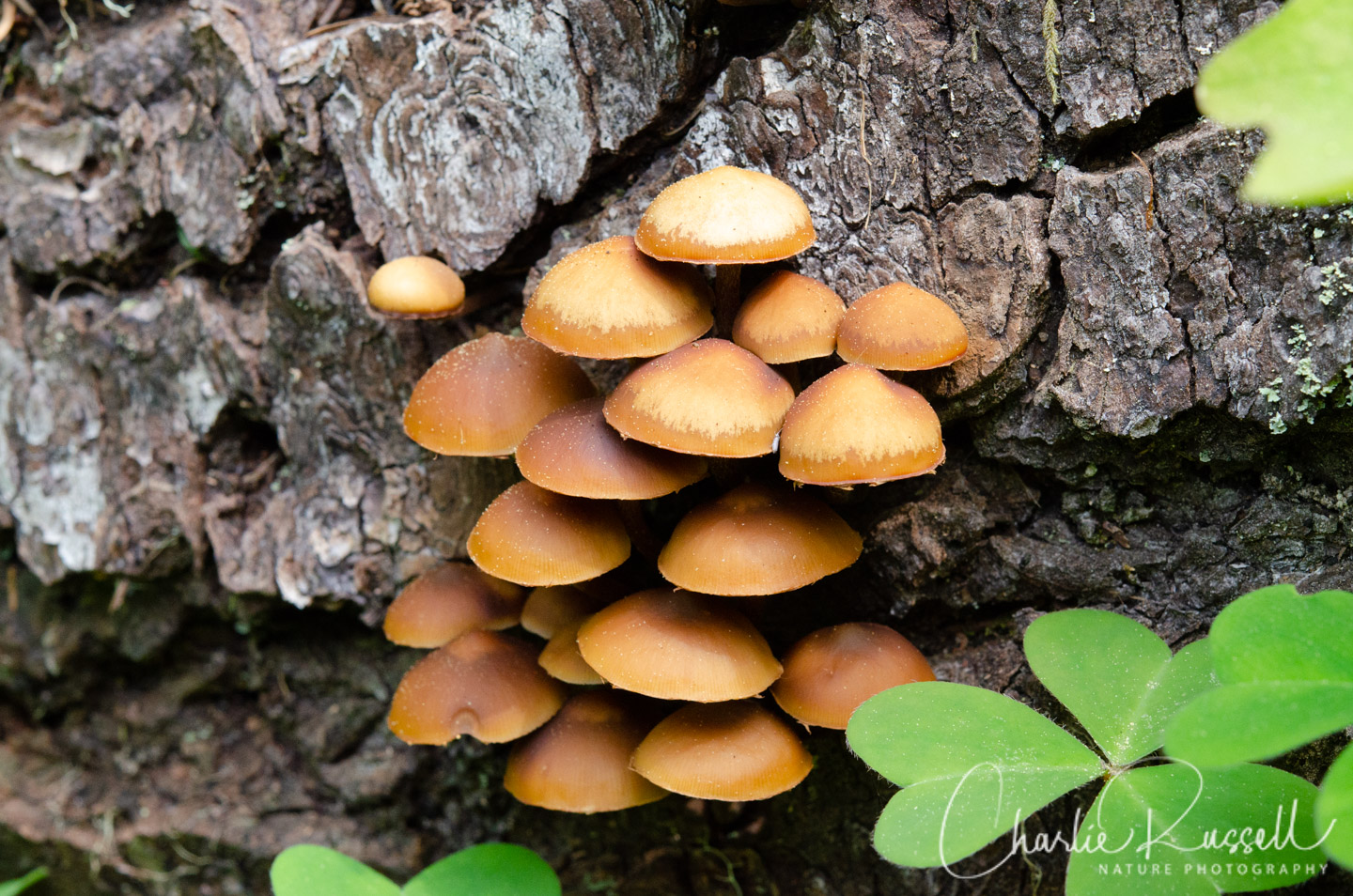
Heading into the forest, at first it seems very dry and bleak. This is one of the most extensive stands of Noble Fir in the Coast Range, with trees around 150 to 200 years old (with some as old as 250 years).There isn’t much growing under the dense shade of the trees in the first section, but as you continue on you get to the moister side of the mountain, and the ground is carpeted with masses of greenery. This area really is amazing and beautiful!
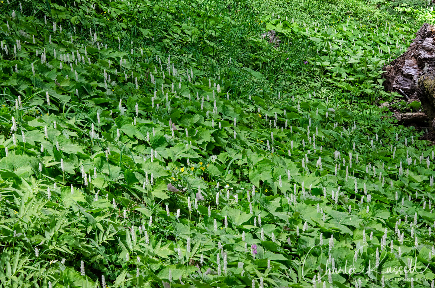
Sometimes you will see millions of Redwood sorrel, another section may be hillsides of Starry false lily of the valley. I’ve not seen such a profusion of these plants! Most of the masses of plants were just starting to bloom, I would expect to see carpets of white flowers in a few weeks. However, there are many other interesting flowers scattered along the trail.
As you continue you will head down the hill, and you’ll start to see a mix of other trees (Douglas fir and Western hemlock) along with the Noble fir. As the forest composition changes, the varieties of flowers you will find starts to change too. At about 1 3/4 mile the loop reaches the lowest point, and you will walk along a stream (or stream bed, it might not have much water). Bleeding heart, trillium, several kinds of flowering shrubs, different than what you’ve seen before.
Eventually he trail starts to climb back up the hill. Around 2.5 miles in, the trail reaches the upper meadow, and it continues along the edge. On this visit this section was the best for fresh Oregon fawn lilies. Portions of the meadow were solid with Starry false lily of the valley.
On our return down the hill to the parking lot, we decided to not go back on the road. Instead, we took the path to the east as it runs down through the lower meadow.
East Ridge / Tie / North Ridge Trail
Another great loop hike at Marys Peak Botanical Special Interest Area is start with the East Ridge trail, switch over to the Tie trail, then return to the parking lot via the North Ridge trail. This is a 4.3 mile hike with a fair amount of elevation change, and since it is lower down on the mountain you will get a different selection of flowers in bloom than found on the Meadowedge trail.
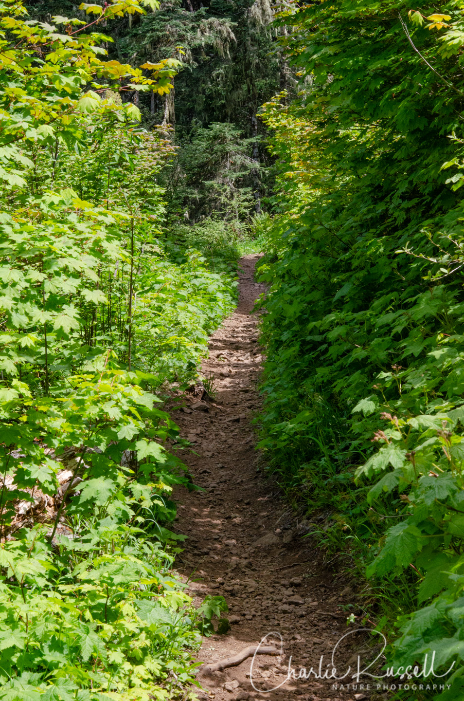
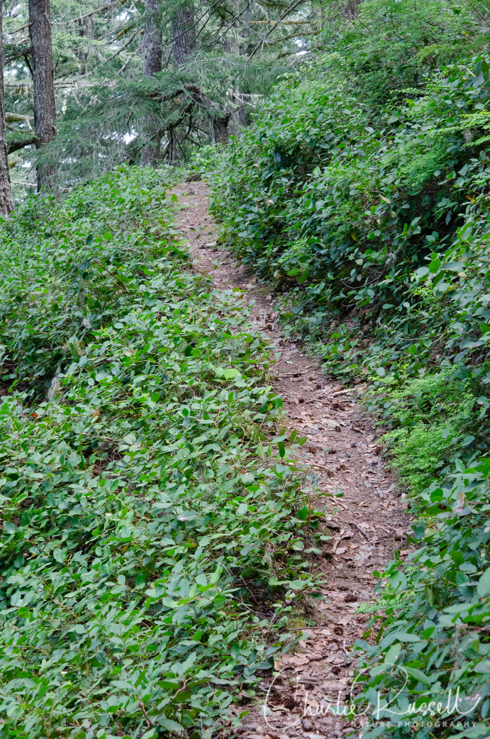
Note that these trails (unlike the Meadowedge and Summit Loop trails) are open to mountain bikes, so pay attention to your surroundings. On our visit (a weekday) we saw only one biker. It was important for me to pay attention (or, better yet, have my partner pay attention) because the trail often is narrow with few places to stand aside, and the flowers are right along the edge, so I was usually kneeling down on the trail to get my photographs.
The East Ridge trail starts on the southeast corner of the parking lot and descends fairly rapidly down the forested mountainside. Some sections traverse across the steep hillside, some sections are more level and you wind through shrubs on both sides of the trail. There were hillsides of Vanilla leaf and Starry False Lily of the valley at the start. This trail begins at the same elevation as the start of the Summit loop trail, so at first you get a similar collection of woodland flowers, but as you progress you will find many different plants than you find on the higher hike.
Just short of 2 miles into the hike the East Ridge trail meets the Tie trail. You can continue to descend on the East Ridge trail, which will end at another parking lot further down the mountain. On this visit we turned north (left) onto the Tie trail to make this a loop that would return to the parking lot we started at. This is a fairly dense forest, mostly Douglas Fir (the cones littered the pathway).
Watch the trail itself, we saw quite a few of the black and yellow Flat-backed millipedes crossing the trail. Probably the Almond-scented millipede, although I didn’t get close enough to smell them (they can exude a fluid that contains cyanide, I’m told).
There are several places where water is seeping down the hillside, which supports an interesting mixture of flowers and ferns. Sitka mistmaiden draped the bank on the upper side of the trail here. I’m not as familiar with fern ID as I am with flowering plants, so please take my fern ID’s with a grain of salt.
At about 3.5 miles you will join the North Ridge trail. If you turn south (left) this takes you up a fairly gentle grade back to the parking lot. As the forest opens up we found multiple patches of Oregon iris and Cardwell’s penstemon.
Here are the tracks for the two hikes we took:
Mary's Peak Meadowedge loop
Profile
Move your mouse along the elevation graph to show the location on the map. The Refresh icon will re-center the map. The Expand icon will expand to full screen.
Marys Peak East-Tie-North Loop
Profile
Directions
From Corvallis, Oregon, take Highway 20 west towards Philomath. Turn onto Highway 34 west in Philomath for 10 miles, then turn north onto Marys Peak Road. Continue another 9 miles to the Marys Peak Day Use area, which is the end of the road. No drinking water is available here, but there were bathrooms.
Some links with helpful information:
- A brochure with a trail guide
- A plant list for the Marys Peak Botanical Scenic Botanical Area, with additional historical information
- A topo map with trails
Note that there is a day use fee of $5.00 per day per vehicle to park at the Day Use area. You can purchase a pass on site (cash/check only), at any Siuslaw National Forest office, or online at http://www.discovernw.org/
Timing is Everything
This visit was in the first week of June. The weather was overcast and a bit cool. The exposed parking lot was a bit breezy, but once you get into the forest (on either hike) the wind wasn’t noticeable. We found a great variety of flowers on the two hikes.
If you go earlier you may get to see Glacier lilies, but you also have to be concerned with snow. There were still some snow drifts at the top of the mountain. If you come later then I would expect to see quite a show of Starry false lily of the valley and Redwood sorrel on the Meadowedge trail, but you may miss the Oregon fawn lilies. One nice aspect of this site is that there are multiple trails that have different exposures, and there is over 1000 feet of elevation differences (even more if you take the longer one-way East Ridge and North Ridge trails), so if there aren’t flowers on one trail you can find them on the other.
Marys Peak Botanical Special Interest Area Wildflower Listing
Here’s a listing of the native plants that we found on the Summit/Meadowedge trail.
- Beargrass, Xerophyllum tenax
- Candy flower, Claytonia sibirica
- Cardwell’s penstemon, Penstemon cardwellii
- Fairy lanterns, Prosartes smithii
- Field chickweed, Cerastium arvense
- Fringe cups, Tellima grandiflora
- Hog fennel, aka Spring gold. Lomatium utriculatum
- Menzies’ larkspur, Delphinium menziesii
- Nuttall’s toothwort, Cardamine nuttallii
- Oregon fawn lily, Erythronium oregonum
- Pacific bleedingheart, Dicentra formosa
- Red Baneberry, Actaea rubra
- Red flowering currant, Ribes sanguineum
- Redwood violet, Viola sempervirens
- Salmonberry, Rubus spectabilis
- Starry false lily of the valley, Maianthemum stellatum
- Vanilla leaf, Achlys triphylla
- Western dog violet, Viola adunca
- Western meadowrue, Thalictrum occidentale
- Western trillium, Trillium ovatum
- Whitlow grass, Draba verna
- Woodland strawberry, Fragaria vesca
Here’s the list of what we found on the East Ridge/Tie/North Ridge trail loop:
- Alum root, Heuchera micrantha
- Candy flower, Claytonia sibirica
- Cardwell’s penstemon, Penstemon cardwellii
- Cascades oregon grape, Berberis nervosa
- Columbian windflower, Anemone deltoidea
- Common bracken fern, Pteridium aquilinum
- Crimson columbine, Aquilegia formosa
- Feathery false lily of the valley, Maianthemum racemosum
- Nuttall’s toothwort, Cardamine nuttallii
- Oregon Iris, Iris tenax var. tenax
- Pacific bleedingheart, Dicentra formosa
- Pacific coralroot, Corallorhiza mertensiana
- Redwood sorrel, Oxalis oregana
- Rusty hair saxifrage, Micranthes ferruginea
- Sitka mistmaiden, Romanzoffia sitchensis
- Starry false lily of the valley, Maianthemum stellatum
- Stream violet, Viola glabella
- Vanilla leaf, Achlys triphylla
- Western maidenhair fern, Adiantum aleuticum
- Western sword fern, Polystichum munitum
