The Dave Moore Nature Area is a short and easy trail off of Highway 49 near Coloma. It has a short, one mile trail that has a mixture of native and non-native wildflowers, along with some interesting gold rush era artifacts. The first half of the trail is accessible to people in wheelchairs and walkers. I don’t know that I would consider this as a primary destination if you are driving from outside the area, but it is a nice little trail if you are looking for a short hike after visiting the nearby Marshall Gold Discovery State Park, or if you have been hiking on another trail in the area.
The Flowers
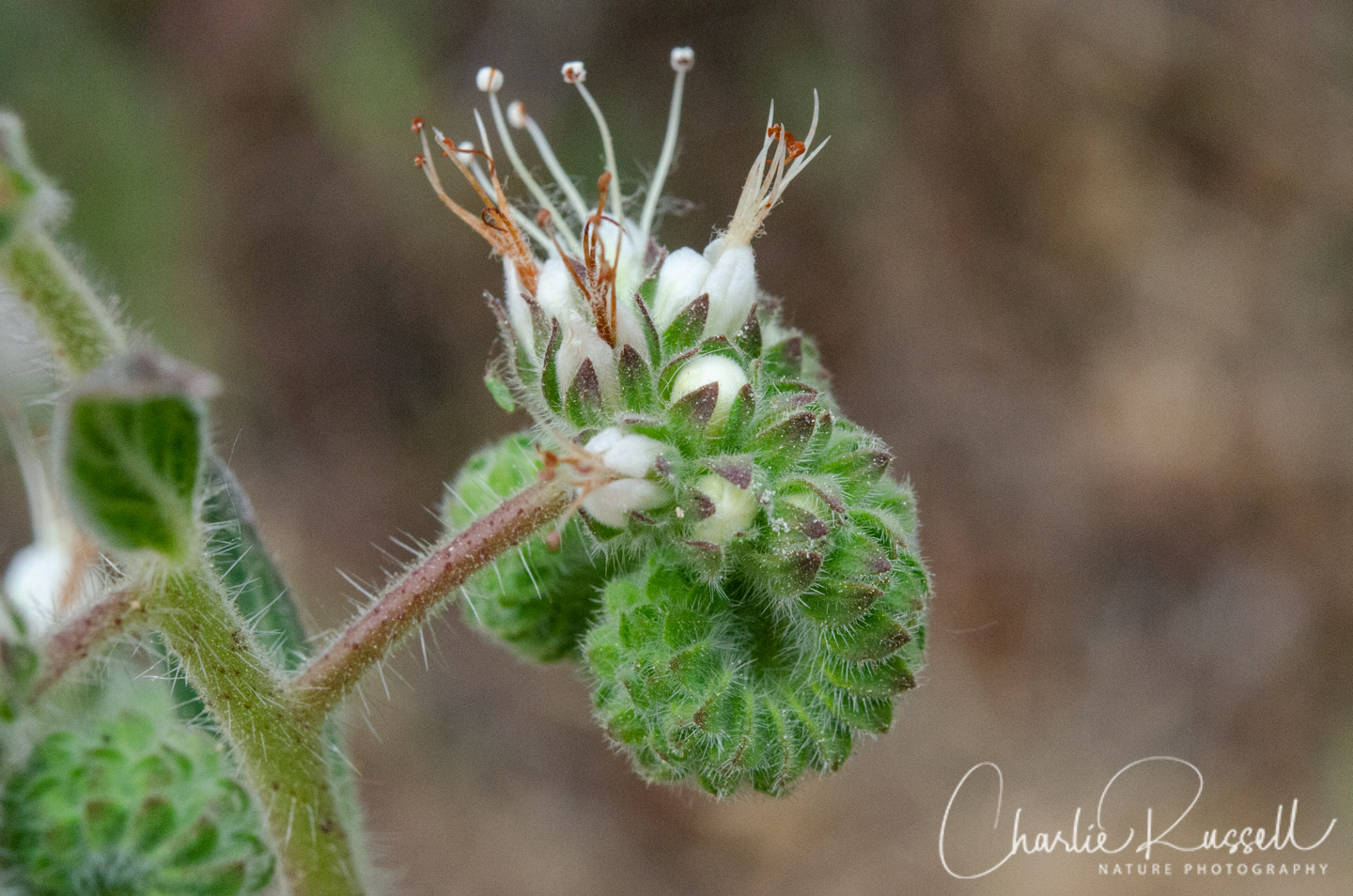
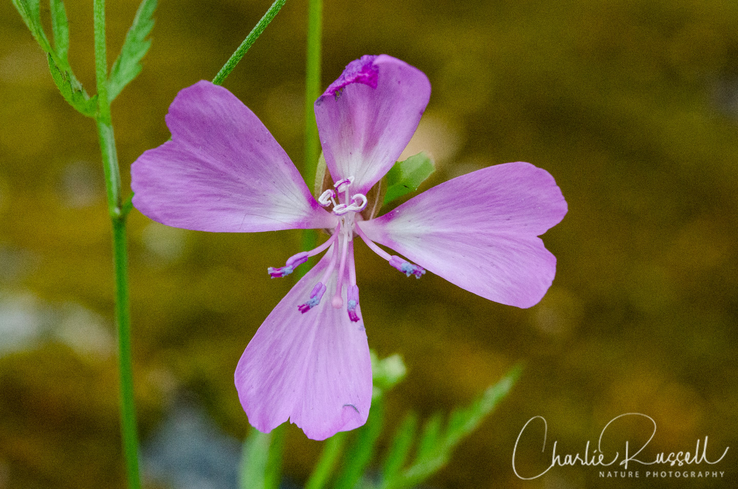
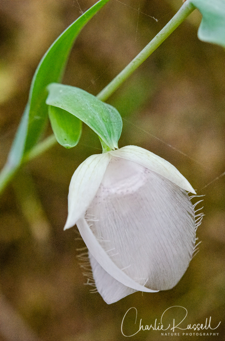
Here’s a sample of a few of my favorites from this hike (click on the image to see a larger view).
Brandegee’s clarkia was the star of this visit. This has a CNPS rare plant rank of 4.2 (limited distribution).
We found a large number of White fairly lanterns along the second half of the trail, on the high bank side (which makes it easier to photograph!)
Also near the end of the trail we found a large number of Pretty face. I think this is Triteleia ixioides subsp. scabra, although it can be hard to pin down the subspecies sometimes.
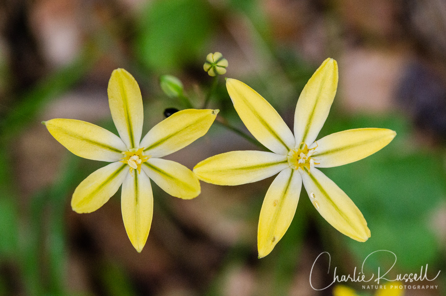
If you click on any of the photos below you will be able to scroll through larger versions of the pictures. The quality of photos isn’t great from this visit because we got there very late in the day, and the light was very low. Some of the flowers were starting to close up.
")


")


")


The Hike
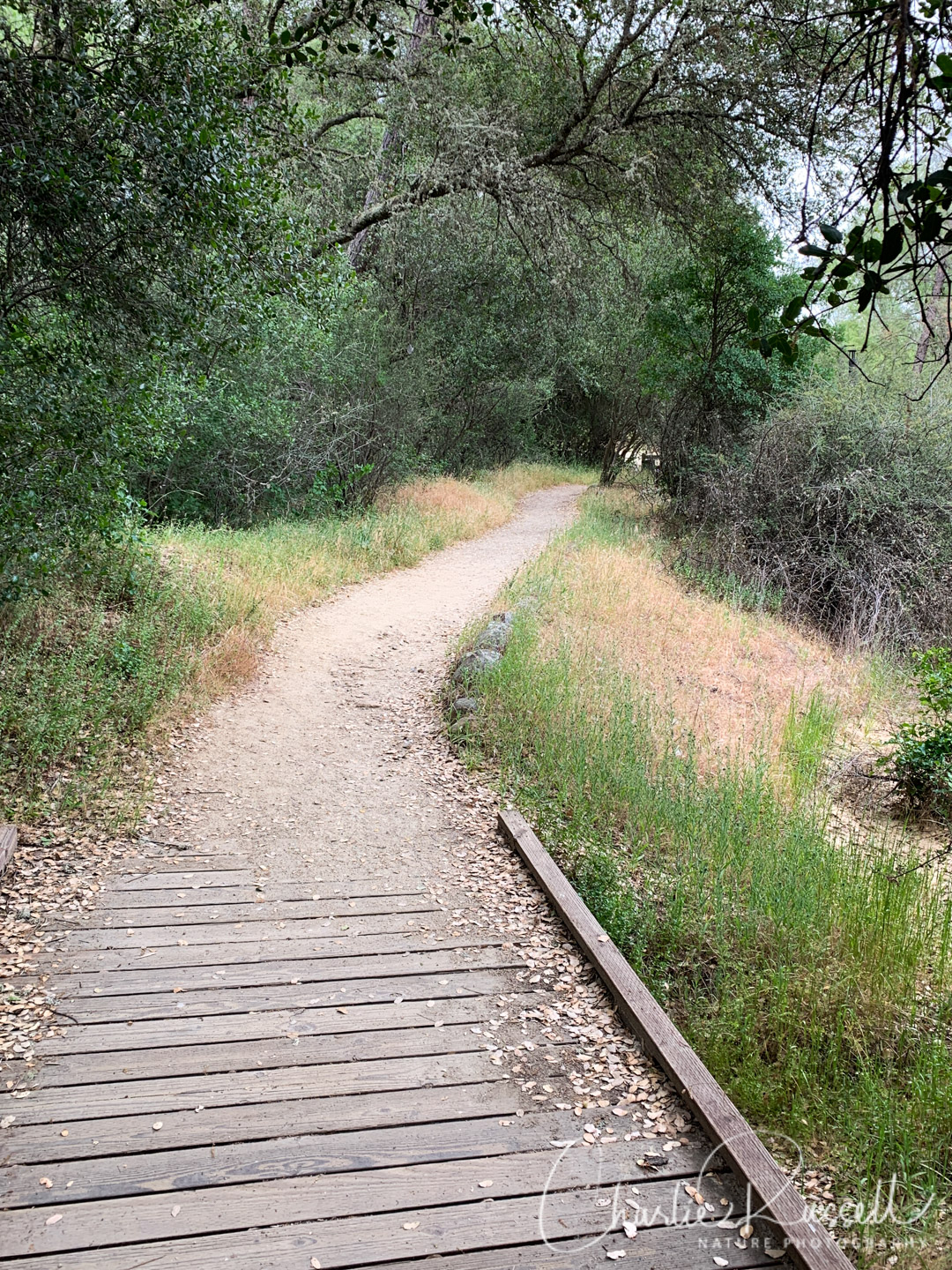
This is a one-mile loop trail. If you go counter-clockwise, the first half of the trail is very flat, with walkways over areas that would be streams earlier in the year. This is designed to be accessible to people in wheelchairs.
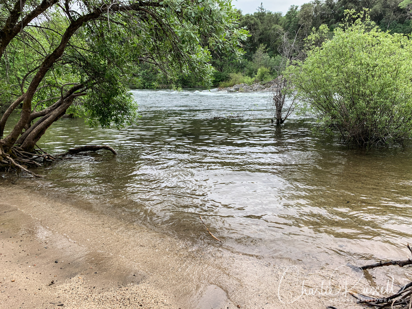
The trail passes by the south fork of the American River, and there is a nice sandy beach.
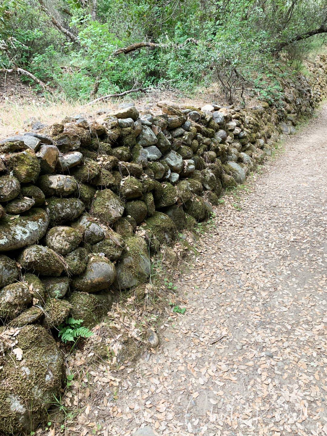
You’ll pass a number of interesting rock walls, which are remnants of the gold rush when Chinese laborers channeled water for gold mining.
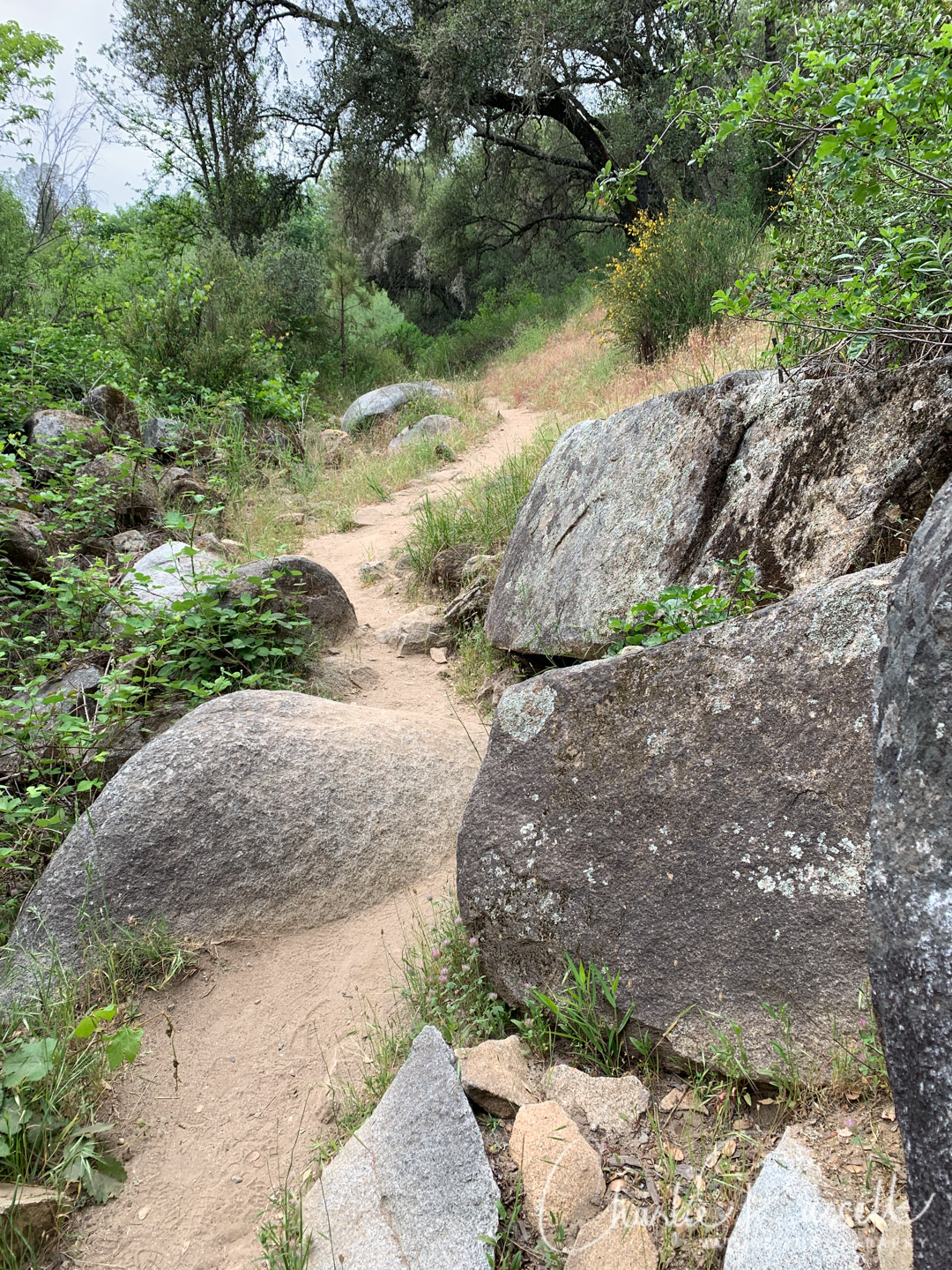
The second half of the trail has sections that scramble a bit over the rocks. We found more native flowers on the second half.
Here’s the track that we followed:
Dave Moore
Profile
Move your mouse along the elevation graph to show the location on the map. The Refresh icon will re-center the map. The Expand icon will expand to full screen.
Directions
The Dave Moore Nature Area is located on Highway 49 between Auburn and Placerville. You’ll see a well-marked entrance on the south side of the highway, about 1.5 miles west of Coloma and the Marshall Gold Discover State Historic Park.
The trail is a popular place to hike with children, as well as to take your dog. Bicycle and equestrian use is prohibited.
There is no drinking water available here, but there is a pit toilet. There are no fees to use this trail.
Timing is Everything
This visit was in mid-May of a fairly wet spring. The area is fairly dry, and many flowers had already gone to seed. However, there was still a good variety of wildflowers. In a normal year, I would say that the best time to visit would be in April, while late May would be past peak.
Dave Moore Nature Area Wildflowers
Here’s a listing of the native plants that we found on this visit. The ones listed in color are endemic to California (that is, found only in California).
- Bluehead gilia, Gilia capitata
- Brandegee’s clarkia, Clarkia biloba ssp. brandegeeae. CNPS rank 4.2
- California mugwort, Artemisia douglasiana
- Collinsia heterophylla, Purple chinese houses
- Common yarrow, Achillea millefolium
- Fringe pod, Thysanocarpus curvipes
- Imbricate phacelia, Phacelia imbricata
- Miniature lupine, Lupinus bicolor
- Poison oak, Toxicodendron diversilobum
- Pretty face, Triteleia ixioides
- Roundtooth ookow, Dichelostemma multiflorum
- Sticky cinquefoil, Drymocallis glandulosa
- Whiskerbrush, Leptosiphon ciliatus
- White fairy lantern, Calochortus albus
- Wild hyacinth, Triteleia hyacinthina
- Winecup clarkia, Clarkia purpurea
- Yellow monkey flower, Erythranthe guttata
As with many areas in the foothills that were actively used in mining operations, there are a lot of introduced plants. This site is no exception. The following are non-native plants that we found on the hike:
- Hairy vetch, Vicia villosa
- Rose campion, Lychnis coronaria
- Sock destroyer, Torilis arvensis
- Spring vetch, Vicia sativa
- Tangier pea, Lathyrus tingitanus
- Windmill pink, Petrorhagia dubia

0 Responses
Yes, that’s Triteleia ixioides scabra, aka Foothill Triteleia.
T. ixioides ssp. scabra and T. ixioides ssp. anilina are both found in the Sierra, but ssp. anilina is generally only found above 2000 ft. The low elevation and the curved-back filament tip appendages indicate this is ssp. scabra. The cream anthers are helpful confirmation, but not definitive. The Jepson key is here: http://ucjeps.berkeley.edu/cgi-bin/get_IJM.pl?key=9562
T. ixioides scabra: https://calphotos.berkeley.edu/cgi/img_query?enlarge=0000+0000+0712+0583
T. ixioides anilina: https://calphotos.berkeley.edu/cgi/img_query?enlarge=0000+0000+0804+0283
Thanks!